MBI Videos
Punit Gandhi
-
 Punit Gandhi
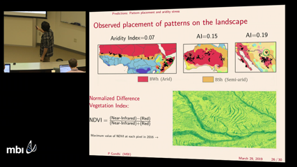
Regular spatial patterns in the vegetation growth of dryland ecosystems are thought to arise through self-organization in response to water scarcity. This behavior has been qualitatively reproduced by reaction-advection-diffusion systems that model various interactions between the plants and their environment. The patterns most often appear on very gentle slopes as bands of vegetation separated by bare soil with characteristic spacing on the order of 100 meters. I will use a simple modeling framework and an idealized topography to discuss the role of water transport in determining (1) the shape of individual vegetation bands and (2) the region of the landscape occupied vegetation patterns. The results are in qualitative agreement with observations from remote sensing data, and suggest that the placement of the patterns relative to ridges and valleys on the terrain may provide some indication of resilience to ecosystem collapse under aridity stress.
-
 Punit Gandhi
Banded vegetation patterns have been observed in water-limited ecosystems across the globe, often appearing along sloped terrain with the stripes aligned transverse to the grade. Initial field observations suggest a link between the arcing of the bands and the curvature in elevation transverse to the slope. We present a simple model that qualitatively captures the influence of topography on the vegetation pattern. In particular, the model predicts that the curvature of the stripes can change direction when growing on top of a ridge versus within a channel. The model also predicts transitions between qualitatively different striped patterns as a function of the channel depth, precipitation parameter and plant mortality parameter.
